
Project: 29th Ave Closure at Midtown Greenway
Location: 29th Avenue at Midtown Greenway
 |
|
|
Photo by Joshua Houdek |
City plans designate 29th Avenue as both a bicycle boulevard and a safe route for Seward students biking or walking to school. Traffic counts taken during the trial closure showed a reduction in traffic around the greenway as well as a few blocks away near the school, transportation planner Forrest Hardy told the committee.
The permanent closure involves installing low barriers both north and south of the greenway, with enough space on either side for bicycles to pass through. The barriers would be low enough to the ground that emergency vehicles could cross over them.
Read moreProject: Marshall St NE
Location: St. Anthony Parkway South to 10th Ave NE
 Marshall St NE has been identified by the four adjoining neighborhood groups, Marshall Terrace, Bottineau, Sheridan, and St. Anthony West as a corridor that needs bicycle and pedestrian improvements.
County maintenance staff have identified that pavement on Marshall will need to be replaced in 3-5 years. The maintenance costs for this corridor are high because of the crumbling (literally) infrastructure, so reconstruction should happen sooner rather than later.
Read moreProject: Washington Avenue
Location: Hennepin Ave to 5th Ave Downtown

Hennepin County will finish its reconstruction of Washington Avenue from Hennepin Ave to 5th Ave in downtown Minneapolis in 2017.
Additionally, the County will re-stripe the lanes on Washington Avenue from 5th Ave to I-35W. This re striping will reduce the outlined portion of Washington from three lanes to two, leaving room for full-time parking and bikeway. It is a fantastic opportunity to extend the protected bikeway on the reconstructed segment almost to the University of Minnesota.
Read moreProject: University Ave/4th St SE
Location: Between 10th St and Oak St
 The City is leading the outreach, working with County. Simon Blenski is the lead at the City. A group of stakeholders has been formed that includes businesses in the corridor, UMN student groups, and staff at the Minneapolis Bicycle Coalition.
Read more
Project: 3rd Ave South
Location: 3rd Ave South from 1st St S to 16th St E
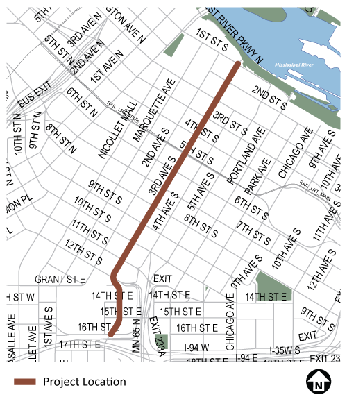
The first-ever Minneapolis planter protected bikeway may be installed next year on 3rd Avenue S Downtown! It's part of a broader plan to redesign 3rd Avenue as a greener, safer connection for biking and walking connecting the Convention Center (and points south) with the River (and points NE).
Read more
Project: Franklin / Cedar / Minnehaha
Location: Intersection of Franklin, Cedar, Minnehaha
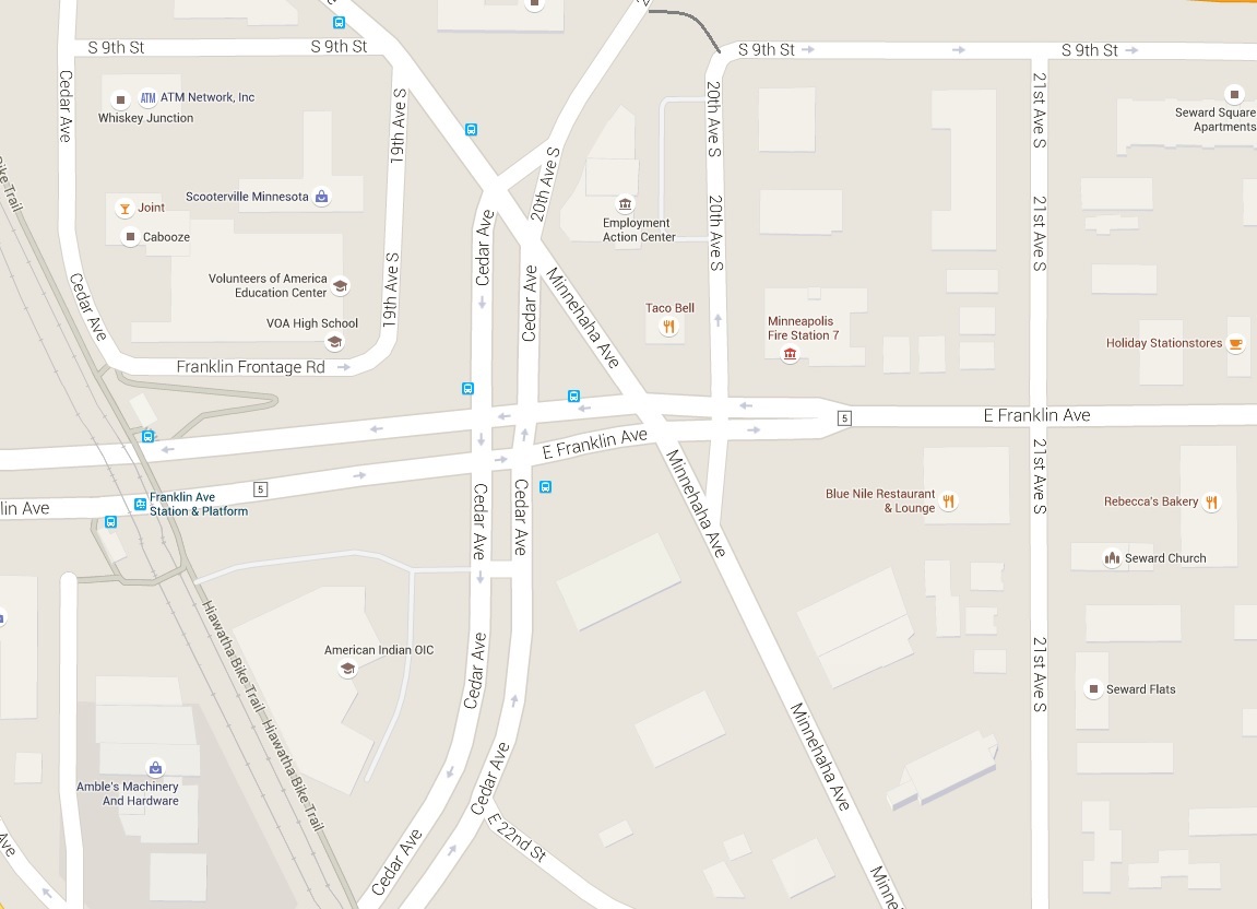
This intersection has the second most bicycle crashes of any intersection in Minneapolis and it’s also one of the most dangerous intersections in Hennepin County, with crash rates more than two and a half times the “critical rate.”
Hennepin County and the City are working together to reconfigure this dangerous intersection to better serve all road users.
Read moreProject: Hennepin Ave
Location: Hennepin Ave from Washington Ave to 12th St N
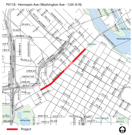
The City is looking to rebuild Hennepin Avenue in the heart of downtown in 2020. They will be starting community engagement about what that will look like very soon.
Discussions will certainly include the potential for a protected bikeway (which would be coupled with taking out the one on 1st Avenue). We are interested in how we can support a truly great Hennepin.
Read moreProject: North Minneapolis Greenway
Location: Irving, Humboldt from Shingle Creek to Bassett Creek

There is a robust community engagement process around a potential street to greenway concept in North Minneapolis, directed by the North Minneapolis Greenway Council.
![]()
Project: Southside Greenway
Location: 10th, 11th, or 12th Ave from Downtown to Richfield

The Southside Greenway project is looking into community support for a safe and inviting route which would connect 12 parks in Downtown and South Minneapolis, using the concept of a "greenway," where cars are not the number one priority. The concept of a "full greenway" converts a residential street to a neighborhood park. This project is in the early planning and surveying stage, and an exact route has not yet been selected by the community.
Read more


